High-tech tools give us insights into animals' lives and their often remote habitats.
Animal-Borne Imaging
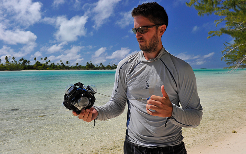
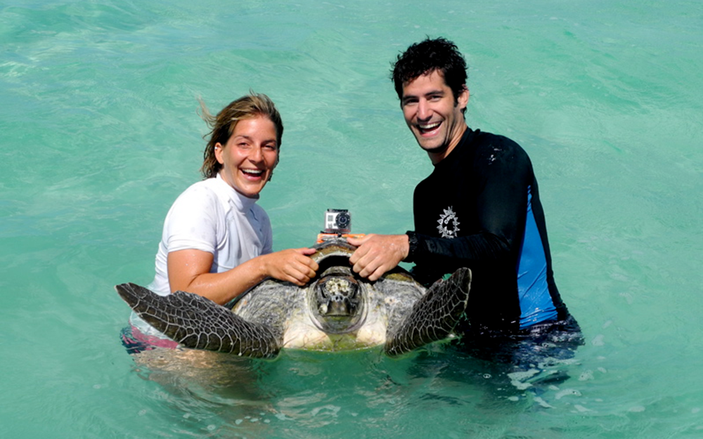
Animal-borne imaging and environmental data collection systems (AVEDs) were deployed in 1999 to gather detailed data on turtle diving, foraging and social behavior. Beginning with the deployment of National Geographic’s Crittercam on green and loggerhead turtles (1999-2004), our lab now uses several types of custom-built systems that feature a video camera (some using GoPro cameras) and a Wildlife Computers MK-10 time-depth recorder that can record the GPS position of the turtle each time it surfaces.
To gain long-term insights into turtle diving behavior that is not possible with AVEDs, we began deploying time-depth recorders (TDRs) in 2005. The small packages include the TDR, an acoustic transmitter (works through water up to 1000 meters) and a VHF transmitter (works through air up to 20 kilometers) set in syntactic foam. The combination of VHF and acoustic transmitters allows the lab to find the turtle during 5- to 7-day deployments to identify which habitats it is visiting.
In 2005, our lab teamed up with the Department of Environment and Conservation (DEC) and the Yadgalah Aboriginal Corporation to attach satellite transmitters to three female and two male loggerhead turtles. The tags gave daily positions (with an accuracy of hundreds of meters) for the turtles for up to a year. The study is ongoing, with nine additional transmitters attached to help shed light on previously unknown movements and behaviors of male turtles on and between foraging grounds and their breeding grounds.
C-PODs
C-PODs (Chelonia Ltd., Cornwall, U.K.) are static passive acoustic monitoring devices that detect echolocation clicks produced by toothed whales. These monitors will be used to assess variation in dolphins' relative abundance at a fine temporal scale in the Shark River Slough. CPODs have been deployed since

Drones
Drones (UAVs) have grown in popularity in recent years. They were primarily used by recreational hobbyists and filmmakers, however, rapid advances in UAV technologies along with an expanding variety of models have caught the attention of many other users.
The science world recognized the potential for using drones as research tools early on, especially once the autonomous flight capabilities were developed. The ability to upload detailed flight plans has allowed researchers to have a repeatable way to survey a variety of landscapes as well as make observations from a variety of viewpoints that may have otherwise been unobtainable.
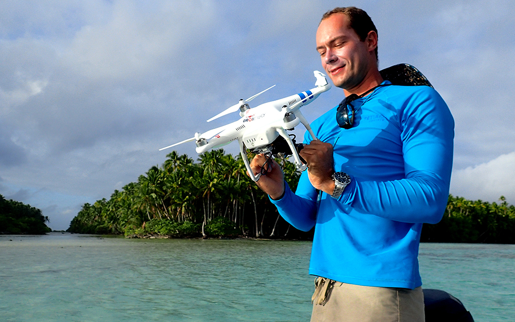
In French Polynesia, drones have been used in Tetiaroa and Moorea to investigate shark, ray and sea cucumber populations. Video captured by drone flights can give us information on habitat use, distributions and, in some cases, behavior.
In West Africa, we are evaluating whether drones can be an appropriate tool for monitoring crocodile populations. So far we've used drones to count crocodiles in Pendjari National Park (Benin), Comoe National Park (Cote d'Ivoire) and Azagny National Park (Cote d'Ivoire).
(e)DNA
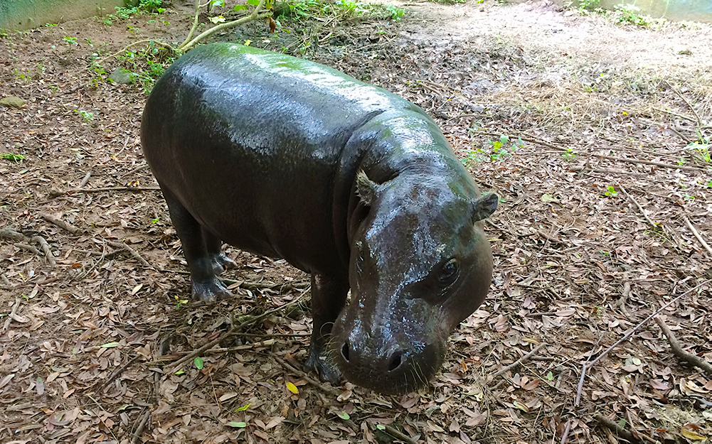
Environmental (e)DNA is a cutting-edge technique through which DNA can be extracted from water samples, facilitating species detection. It enables effective deployment of limited conservation resources by eliminating the need for extensive man-hours in the field. Through the use of (e)DNA, we are developing a low-cost, time-efficient detection/monitoring protocol to rapidly detect and survey four reclusive, cryptic species – the critically endangered West African slender-snouted crocodile, endangered pygmy hippopotamus, endangered West African dwarf crocodile and vulnerable West African manatee. Furthermore, by combining (e)DNA sampling with metabarcoding techniques, we're expanding the utility of our samples to detect virtually any species present in this environment.
Telemetry
Understanding the patterns and drivers of animal movement and habitat selection is essential for effective management and conservation.
We've investigated the movements and ecological roles of two of the Florida Everglades' largest and most abundant estuarine apex predators, bull sharks (Carcharhinus leucas) and alligators (Alligator
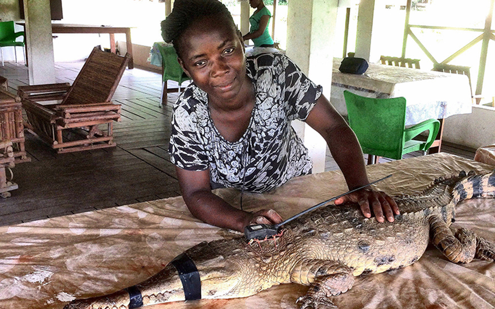
In Africa, we are using both VHF and GPS/Argos transmitters to better understand crocodile movement ecology and habitat selection. West African slender-snouted crocodiles are one of the most critically endangered species in the world, but before we can start reintroducing
Nile crocodiles are one of Africa's largest apex predators and are known to enter into conflict with local communities. We are using GPS-Argos transmitters in Gabon to better understand how Nile crocodiles move through human-dominated
Also in Africa, we are using VHF telemetry to better understand pangolin resource selection. Pangolins are among the least-known mammals in the world and have thus far proven very difficult for researchers to detect and follow in the forest. We are tagging black-bellied and giant pangolins in protected areas in Cote d'Ivoire to better understand their habitat selection. By doing focal follows on tagged pangolins, we are able to better understand their prey selection – which may serve as a more visible index for pangolin ecological monitoring.
In the Gulf of Mexico, movements of Bryde's whales are measured with satellite telemetry tags. These tags are attached to the whale and utilize ARGOS satellite communications to transmit locations of the individual for periods of 30-50 days. Tags are deployed and attached using the "LIMPET" minimally invasive attachment housing. We also use Wildlife Computers SPOT-6 position-only tags, which can provide location information at
The data provided by the tags help us to define the habitat use patterns for Bryde's whales. By having a better understanding of their spatial movements and critical habitats, we can help the management and recovery of the Gulf of Mexico population.
VR/Video Monitoring
Video surveys are increasingly being used to survey the marine environment. In addition to being non-invasive, these techniques provide insights on species' behavior, habitat selection and spatial distributions. However, the question often remains, what is just outside of the camera's field of view? Using newly developed full-spherical camera technology, we are finally beginning to answer this question. By filming with six independent cameras, we are able to render videos with a complete 360-degree horizontal by 360-degree vertical field of view, enabling a fully immersive virtual-reality experience. Using this emerging technology, we hope to develop educational materials that engage viewers in a way never before possible, while also advancing the use of video technologies to study marine ecosystems.